

Project Type: Environmental Compliance / Permitting / GIS
Route 206 Over Stony Brook Bridges Reconstruction and Replacement
Princeton Township, NJ
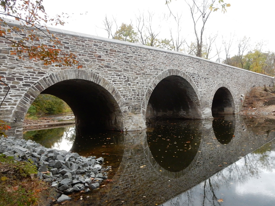
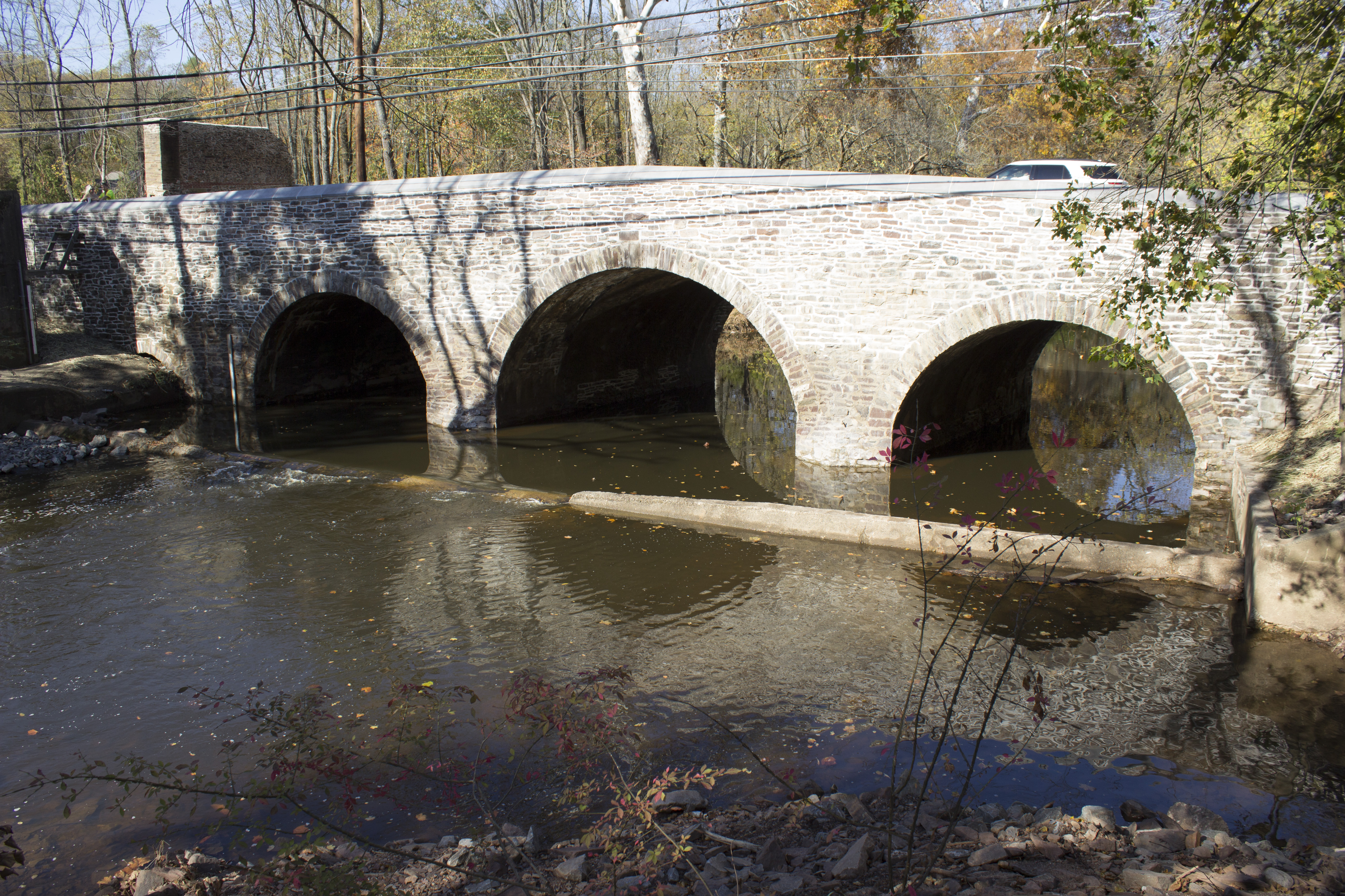
The Route 206 bridge over Stony Brook is a three-span masonry arch structure originally constructed in 1792 and widened in 1916 and is the oldest highway bridge in use in New Jersey. The hydrologic and hydraulic analysis required multiple HEC-RAS runs with varying stages in the hydraulic openings to determine the flood inundation levels during construction to facilitate the staged construction of each arch structure. The arch was modeled as blocked during the staging to determine the best combination for protection during major storm events of the work. A secondary single span bridge in the overbanks that provides relief during inundation of the arches to help avoid overtopping was modeled during construction staging. The analysis included the modeling of a relief bridge in the overbanks to protect historic ruins which were in direct conflict with the overflows and required adjusting expansion and contraction coefficients to model the effects on the stream flow and velocities in the channel.
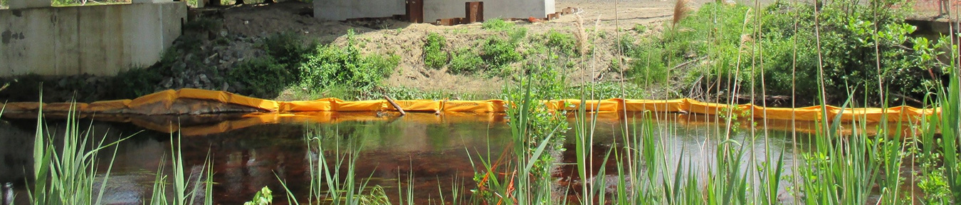
Articulated concrete block matting provide erosion/scour protection. A small riprap line rectangular channel was designed to convey low flows under the relief bridge to avoid ponding below the relief bridge and provide flood improvements to adjacent private properties. Riprap stones were sized to provide erosion protection for the low flow channel discharging back into the mainstream. The relocation of the new outfall provided a stepped outfall system with drop manholes to discharge to a stable condition.
Arora coordinated with NJDOT, reviewed and prepared the environmental permit applications and plans, and secured all permits. Coordination with SHPO was required throughout the project due to the historic nature of the arch bridge.
Responsibilities included the H&H analysis of the three arch culverts and secondary relief bridge. A scour analysis using HEC-RAS in compliance with HEC-18 Evaluating Scour at Bridges design guidelines was performed to determine the proper scour countermeasures along the relief bridge and the three arches. The project used HEC-RAS to analyze multiple stages of the arches during construction to determine safe staging procedures. The project hydrology was developed using TR-55 methodology (equivalent to HEC-MMS & TR-20) with the NRCS 24-hour rainfall curves used to estimate the runoff rates. The tributary drainage areas to the bridge were developed using TR-55 with the most remote time of concentration (Tc) flow path. PondPack and InRoads Storm and Sanitary (equivalent to HydroCAD) were used for the routing of the flows within basins and closed drainage systems. A gutter flow analysis used the drainage areas to determine required inlet spacing to maximize the inlet interception efficiencies and meet the allowable spread criteria. The pipe collection system was designed using the rational method with a hydraulic grade line analysis to avoid overtopping of the inlets.